

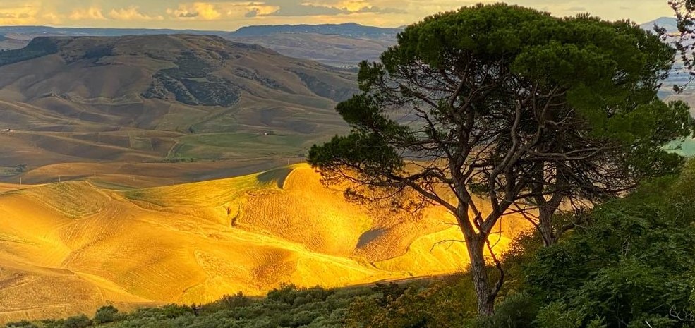


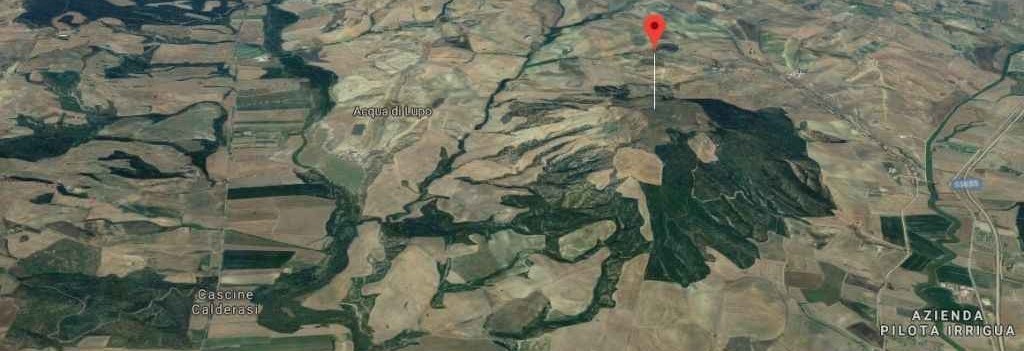
Mount Irsi is eleven kilometers from Irsina, an area of extraordinary importance for the presence of the archaeological site and of great scenic beauty. Like the nearby hills of Timmari and Altojanni, it has an altitude of just under 500 meters and has a plateau on its top, a feature that has favored human settlement. Its slopes fall on the right bank of the Bradano river on the south side, while along the north side flows the Basentello which after a few km joins the Bradano, just upstream of the San Giuliano reservoir. On the side from which Irsina can be glimpsed, there is a deep valley crossed by several streams that descend from the Irsina hill including the Fosso Acqua di Lupo stream that gives to the district its name.
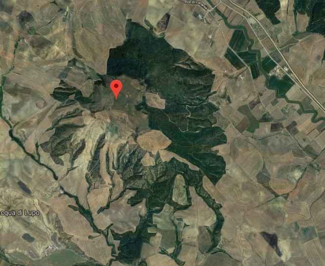
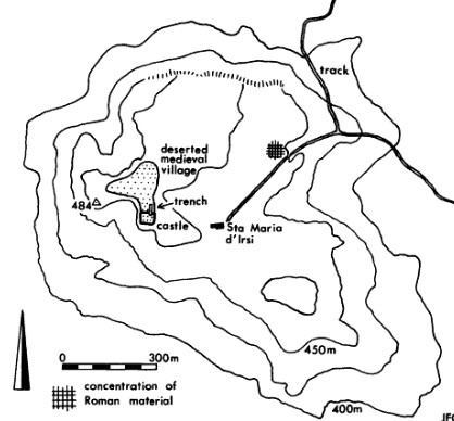
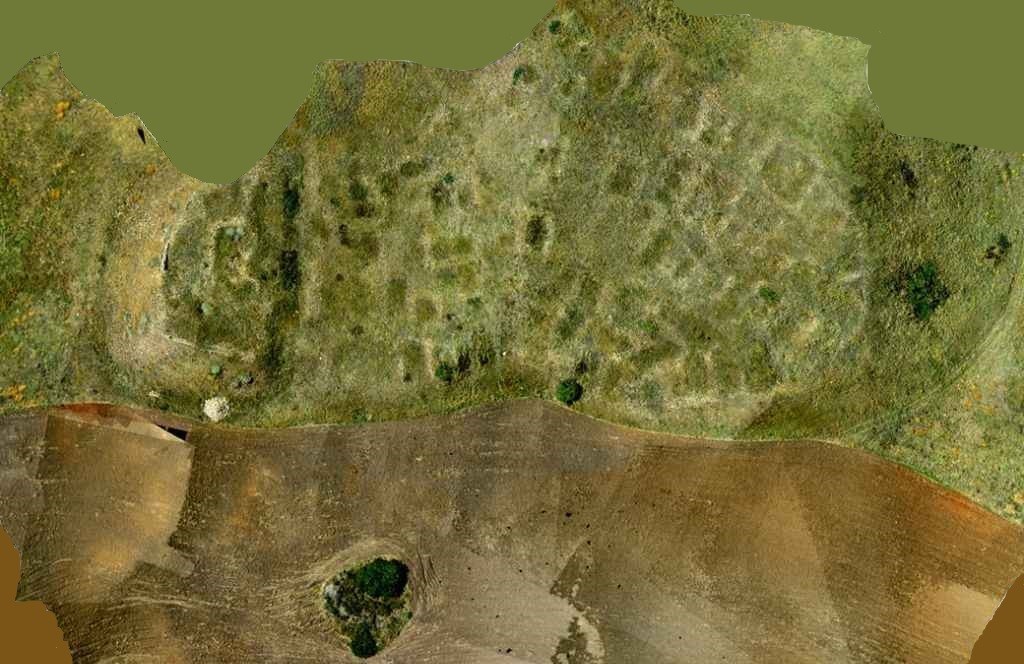
Mount Irsi has never received much attention from the scientific community and only a few foreign expeditions have conducted serious investigations into the archaeological heritage that the mountain offered. After the interest of the University of Cambridge, a group of Canadian archaeologists, headed by prof. Alastairs Small, funded by Canadian universities, has begun a series of investigations conducted scientifically and not just speculatively.

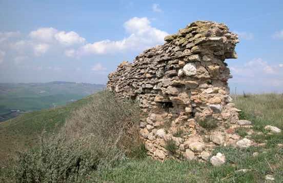
From the results presented by prof. Small it appears that the mountain was frequented by Peucete populations between the eighth and third centuries BC. The population lived on an agricultural-pastoral economy and like many other "Apennine" communities, the animals bred were mainly sheep and goats for the production of wool, cheeses and meat, while the cattle were mainly used for plowing the fields. The area was defended by a terrace wall, typical of the Iron Age, which surrounded the top of the hill, as shown by an archaeological survey of the site, and extended over an area of approximately 32.5 ha. Transhumance was widely practiced as well as in the period following the Roman conquest (II-I century BC).
Like other nearby sites such as Timmari and Botromagno (Sydyon), the Peuceta village of Irsi will also pay dearly for the choice of having sided with the Carthaginians and shortly after the defeat of Hannibal (201 BC) the village was abandoned. In addition to partially deporting the local population, the Romans throughout the area confiscated their lands and founded several villas belonging to Roman patricians thus controlling the vast estates acquired.
A first villa was built around the middle of the second century BC, it was 55 m long, had nine rooms on the south side and a large number of open spaces, probably used as stables for oxen, whose measurements correspond to those reported by Roman agronomists. The Roman republican villa was destroyed in 70 BC. during the Spartacus wars.
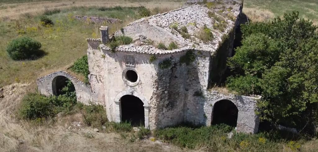
A second villa which lasted the first two imperial centuries of our era was finally built. Some remains are located next to the medieval monastery converted into a church much later.
In the area overlooking Irsina there are the ruins of a medieval village that disappeared in 1360, the year when it was abandoned by the last monk to shelter in Montepeloso (ancient name of Irsina). A reference about the medieval settlement of Monte Irsi dates back to 988, when it was destroyed by the Saracens together with Montepeloso. During a clearing operation of the area, Byzantine coins of an earlier period were found dating back to the first half of the 800 and the first half of the 900. Just after the expulsion from Bari of the Arabs, and therefore the parenthesis of the Arab Emirate of Bari closed ( 847-871 AD), the Eastern Roman Empire launched a large-scale offensive to conquer Southern Italy. The Lombard principality of Salerno which nominally boasted possession of this part of Southern Italy did not have the military capabilities to oppose resistance to the Byzantines and it is therefore very probable that as for nearby Matera, even Irsi, entered the Thema of Longobardia during the second half of the 9th century. The bull of Callisto II of 1124 includes it among the possessions of the Montepelosino (Irsinese) episcopate a castrum Ursum, donated to the monks of the Chaise-Dieu of Juso in 1133 by the Norman Roger II.

The first information on the characteristics of the urban layout occurs in the Angevin period, when there was a fairly populated farmhouse on the mountain. The events of the farmhouse and monastery of Irsi were no different from those of Montepeloso: destroyed by Roger II, they then passed under the control of the Chaise-Dieu di Juso and were definitively abandoned in 1360, during the Black Plague period. Recent surveys, photographic surveys and the processing of high-resolution multispectral images of the QuickBird satellite have shown the presence of archaeological emergencies, such as walls, walls and paving stones buried for 690 m, on an area of 40 hectares, located in the northern and central area of the hill, where the farmhouse was located. The current church, the result of the sixteenth-century reconstruction, has a single nave with a terminal apse. In the eighteenth century, then, the nave was reduced and the liturgical order of the church was reversed.